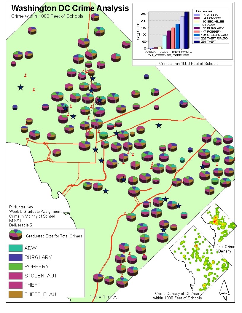
Method: 1000 foot buffers of schools to display crimes. Crimes were then spatially joined to the schools and then a pivot table was created and joined back to the school layer. This provided the school, type of crime, # of those crimes and total crimes occured near the school. This feature class was then used to create gradient pie chart symbology to distinguish the volume of crime in size and the break down by offense. The graph at the top provides the breakdown of crimes in school zones, and the lower right maps show density of total crimes and crimes near schools.
Deliverable 2 - long and tedius instructions but no difficulties in the tasks.
Deliverable 1
Tuesday, July 7, 2009
This was the deliverable 3 and 4 with density of crimes and a graph of times. In the lower right is the Population density for comparison.
The only problems I had was with the multiring bufffer that has been well documented, and the definition of "crimes" layer.
This is the base map of the Houston area. No problems other then a gangly road layer that had some redraw drag.
Sunday, July 5, 2009
Ran into some problems with the demographic files.... but this was the base map for an analysis of a home search based on quality of life.
The write up was to assess home income, areas with kids the same age as mine, and proximity to work and boat ramps. The idea for the boat ramp was to live were I could paddle before or after work.
I provided a basic dempgraphic analysis for my work http://www.glynncounty.org/index.aspx?NID=780 and had no problems with joins and connectivity. The only difference between the two was utilizing the VM or utilizing Enviornments.
The error message that I recieved that left me bogged down in troubleshooting:
"Could not load data from the data souce. If you can correct the problem, press the refresh button and reload data. Possible problems can include bad network connection, Invalid field, etc An invalid SQL statement was used. Item not found in this collection.
The Plan, if it had not been such a personal time short week: Download and do the assignment on a work computer utilizing environments, second do the assignment without envirnments. These are the two aspects that I have limited experience with.
The variations in the two weighted value maps provide the home buyer with some advantages and disadvantages when viewing each map representation.When the Doctor and Professor utilize the equally weighted search criteria map, they will have the advantage of viewing blocks that meet all three objectives first. The disadvantage to this view, however, is that it might inadvertently exclude an ideal search area due to a low rank in one area. The Second weighted value map places a greater importance on the distance to Phoenix College and Chandler Regional Hospital. The advantage of this is the map accentuates the blocks between the two work sites and provides extra weight to those blocks in between with median home value and population age. The disadvantage, however, is a block on the South East side of Chandler Hospital might reflect an optimal choice as equally as the North West side of Phoenix College. This however would mean create block that might have great driving times for one individual but not the spouse, meeting only half the distance criteria and minimally the age and house values.
Monday, June 22, 2009
Weighted overlay.... As you can see the optimal sites are a little different then the display. I think this is because of my lack of clarity of what the reclass was.... I had some outliers in my reclass, that seem to tweak the classes.
This is the four part harmony of the Maricopa House location for the good Dr & Prof.
I was clear on the directions and the direction it was going with the Raster, to Reclass, to weighted overlay.... but I had some difficulties on my reclass with the the housing and % age between 40-49. The reclass of 10,000 was clear on the distances... but I ended up kinda making it work with the other two... and while they reflect the data, I don't think the breaks are similar to the display map. This affected the weighted map in the ends not really matching that map display either.
Base Map of Maricopa County.
Monday, June 15, 2009
EIA
3D assignment
Saturday, May 16, 2009
I hope I got this right....I am editing this first post for Applications in GIS from holiday in The Netherlands and all the layouts are in Dutch.... little tricky : )
Sunday, April 26, 2009
The proposed Wind Farm Location in the Great Lakes meets the following criteria recommended by the BERR (Department for Business Enterprise & Regulatory Reform) site.
Wind Speed - The http://www.windpoweringamerica.gov/wind_maps.asp shows the area with a Resource Potential rating of Outstanding, Wind Power Density at 50 m W/m = 600 - 800 and Wind Speed at 50 m mph = 17. 9 - 19.7
Ornithology - http://www.npwrc.usgs.gov/resource/birds/migratio/routes.htm . The Canvasbacks migrate through the Southern Great Lakes area to the Chesapeake Bay area and a portion of the dabbling duck population migrates across the great lakes to the Chesapeake Bay area as well. This would leave a possible area on the southern migration route of the dabbling duck and the Northern Route of the Canvasback for wind farm site.
Noise , Shadow Flicker and Landscape visual - It is over 20 miles to the coast and adequate distance to satisfy all three of the "location to population" aspects.
Shipping Impact - http://www.greatlakes-seaway.com/en/navigating/map/index.html shows that the ports of Lake Michigan are on the South and Western sides of the lakes and would likely see minimal shipping traffic.
It should also be noted it is just off the coast of Holland, Michigan and Windmill Park, so the tourist aspects might be appealing to a community that already considers itself a place to visit for windmills.